Combining Methods
MIPA is the culmination of scientific research that effectively integrates two distinct methods used for locating groundwater supplies. 
The first method that MIPA is based on is onsite analysis with geophysical instrumentation. In this process, measurements are taken of a variety of natural phenomenon. After the data is collected it is rendered into visual format for further analysis. The graphs reveal distortions or anomalies in the earth’s natural magnetic field and provide a good indication of the presence of subsurface water-bearing formations. The primary drawback of onsite geophysical analysis is its limitation in the area that can be surveyed. Additional manpower and instrumentation can be added to address this problem but it drives up the cost astronomically- yet another drawback.
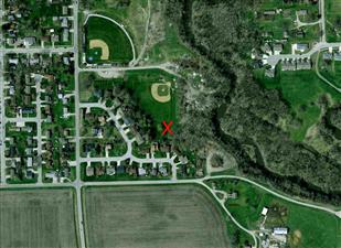
The second method that MIPA is based on derives data through satellite imagery and/or aerial photography. At the present time, the two most popular trends in this field are fracture trace analysis and topographical analysis. Both procedures can survey large areas at one time and are helpful in determining the best areas to focus on when drilling.
Fracture trace analysis pays attention to line segments revealed in the aerial/satellite image, indicating subsurface fractures in bedrock and the potential for an aquifer. One drawback of this method is that it is limited to locating only fractures in bedrock and overlooks any other type of aquifer (e.g. alluvial). Another drawback is that fracture trace analysis only identifies the fracture; but it does not reveal whether there is water associated with it (not all fractures are aquifers).
 Topographical analysis operates from the premise that aquifers are found at specific topographical sites such as: a valley, the head of a valley, or the side of a hill. While this is true in some instances, topographical analysis is not fully accurate because it begins with an assumption that is not true in every circumstance. Drawbacks of this method are that it can only be used effectively in a limited number of geographical regions; and subsequently, it does not locate all types of aquifers.
MIPA combines the best of each of these methods into one very effective application. The key is our discovery of how the projecting subsurface energy of an aquifer affects the surface layers of the earth to the point where it can be detected by sensitive computer software. As a result, unlike other satellite/aerial technologies that only find a geological structure, the signatures that MIPA detects are geophysical in nature and must have fluid associated with them-- otherwise they would not exist.